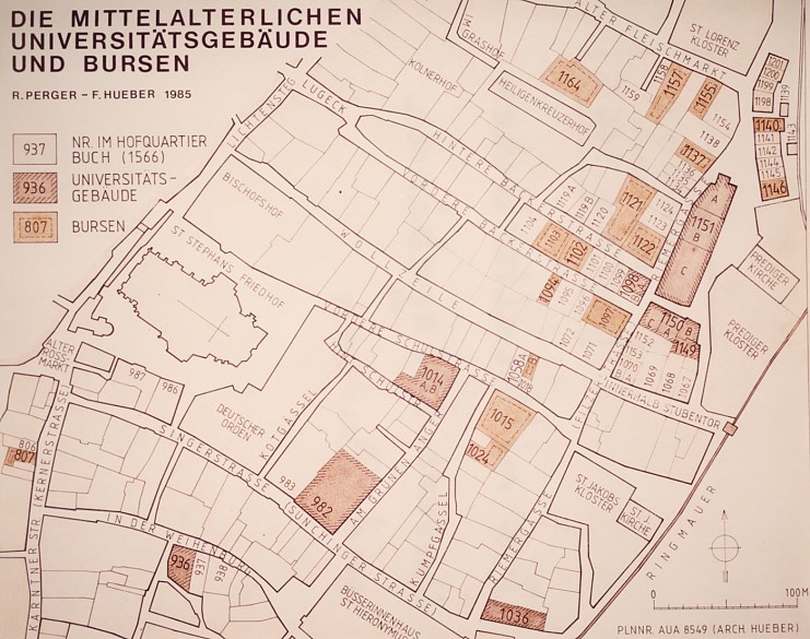
Original map drawn by Richard Perger and Friedmund Hueber: The medieval university buildings and Bursen (hostels), 1985
Original map drawn by Richard Perger and Friedmund Hueber: The medieval university buildings and Bursen (hostels), 1985
The map shows the quarter near the Stubentor city gate with university buildings, ‘Bursen’ and ‘Koderien’. The university buildings are hatched, while the Bursen are indicated with a heavy outline.
Copyright
Archiv der Universität Wien/Helmreich