Map of Vienna, c. 1850

Glacis in front of the Stubenbastei, 1858, after a watercolour by E. Hütter

The city walls before demolition: Kärntnerbastei, photograph

Vienna looking towards the Burgtor (1818-1820), after a coloured copperplate engraving by Jakob Alt and J.A. Klein

A. Sigel: The old Burgtor and the Dominikanerbastei: view of the old Burgtor from outside the city (1819), watercolour

A. Sigel: The old Burgtor and the Dominikanerbastei: view of the old Burgtor from inside the city (1818), watercolour

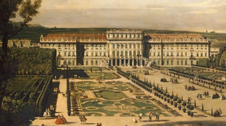
City walls, bastions and glacis – protection or hindrance?

Map of Vienna, c. 1850

Glacis in front of the Stubenbastei, 1858, after a watercolour by E. Hütter

The city walls before demolition: Kärntnerbastei, photograph

Vienna looking towards the Burgtor (1818-1820), after a coloured copperplate engraving by Jakob Alt and J.A. Klein

A. Sigel: The old Burgtor and the Dominikanerbastei: view of the old Burgtor from outside the city (1819), watercolour

A. Sigel: The old Burgtor and the Dominikanerbastei: view of the old Burgtor from inside the city (1818), watercolour

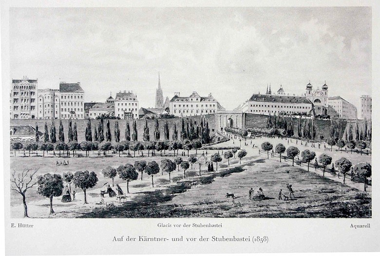
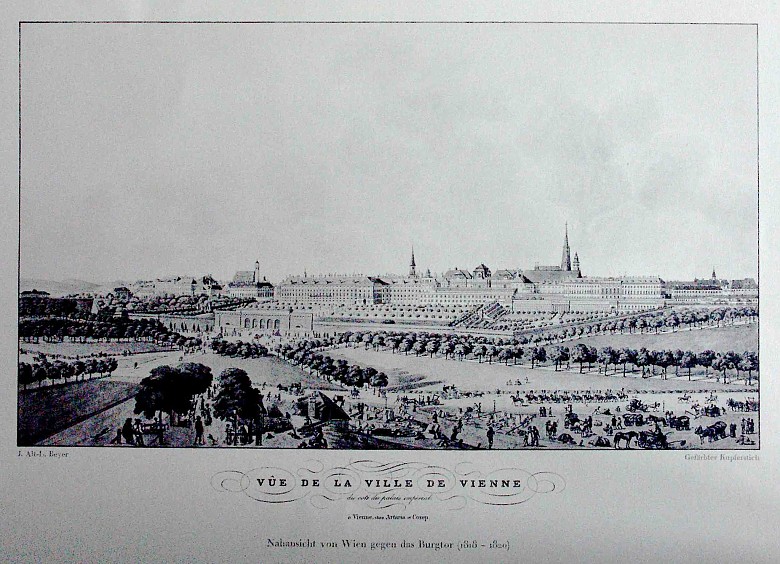
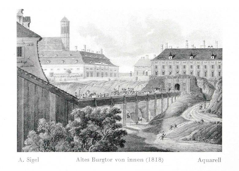
Mid-nineteenth-century Vienna: a defensive barrier consisting of walls, bastions and a glacis surrounds the centre of the city. But the fortifications have long outlived their purpose and are strangling the city’s growth.

Map of Vienna, c. 1850

Glacis in front of the Stubenbastei, 1858, after a watercolour by E. Hütter

The city walls before demolition: Kärntnerbastei, photograph

Vienna looking towards the Burgtor (1818-1820), after a coloured copperplate engraving by Jakob Alt and J.A. Klein

A. Sigel: The old Burgtor and the Dominikanerbastei: view of the old Burgtor from outside the city (1819), watercolour

A. Sigel: The old Burgtor and the Dominikanerbastei: view of the old Burgtor from inside the city (1818), watercolour

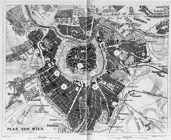
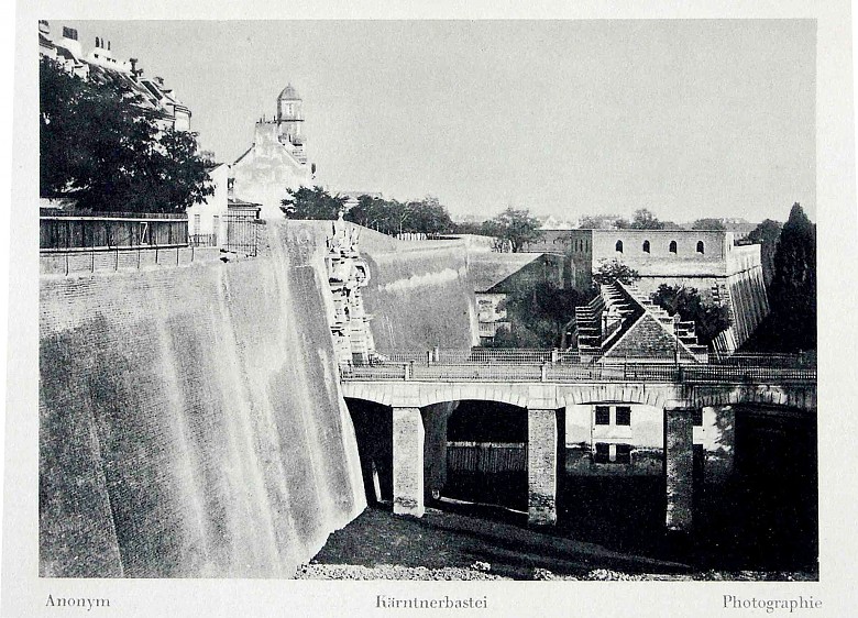
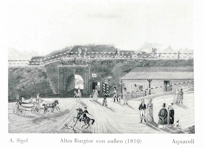
The map of Vienna dates from around 1850 and shows the bastions and city walls that enclosed the city centre; a number of place names such as ‘Schottentor’ (Tor, gate) or ‘Stubenbastei’ (Bastei, bastion) commemorate the fortifications punctuated by a handful of gates giving access to the centre. In front of the city walls was the glacis, an area of open ground that originally provided a free field of fire before the bastions. Between the glacis and the Linienwall, the outer ring of fortifications, today the ring road called the Gürtel, lay the suburbs. These were incorporated into the City of Vienna as Municipal Districts 2 to 9 and 20 in 1850 as part of the programme of urban expansion.

All classes of the population passed through these gates daily from the city to the inner and outer suburbs. Erected as defence and protection during the Turkish sieges in the sixteenth and seventeenth centuries, by the nineteenth century these fortifications had lost their function. Their ineffectiveness had been demonstrated when Napoleon had demolished part of them near the Burgbastei in 1809. They were now merely a hindrance to traffic.

Julia Teresa Friehs